Hiking with Guru Maps

Going for a hike is an excellent way to stay fit, relieve stress, and spend more time in nature. No matter what type of trail you choose, hiking requires caution and a reliable map to find the trailhead and stay on course. Offline topographic maps are crucial when you lack cellular coverage, and the Guru Maps app can help.
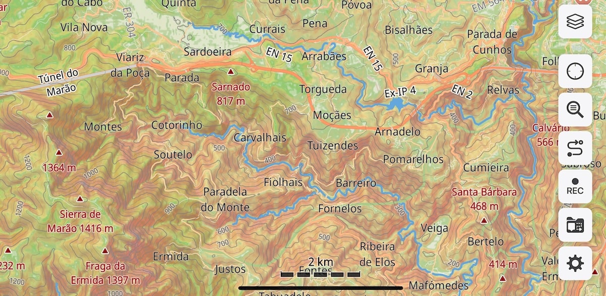
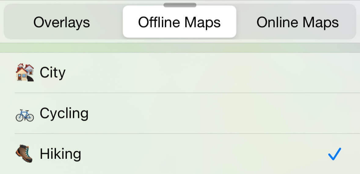
Map style for hiking
In addition to the city and cycling vector map styles, Guru Maps also offers a style tailored for foot travelers.
This map style was designed to meet hikers’ needs by highlighting key trail information such as distance, duration, and elevation.
It’s ideal for anyone who wants to keep track of attractions, sources of drinking water, campgrounds, and overnight spots, while understanding trail difficulty and passability.
Walking and hiking route networks
The hike map style within Guru Maps contains well-known walking routes documented on OpenStreetMap.org:
- International walking network: long-distance paths that cross several countries
red. - National walking network: nationally significant long-distance paths
red. - Regional walking network: routes that cross regions and are regionally significant
purple. - Local walking network: small local walking routes
blue.
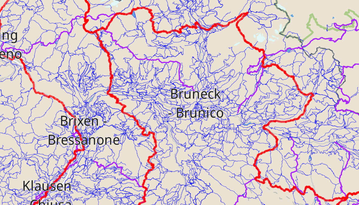
Routes appear as solid lines at higher zoom levels, become more transparent as you zoom in, and disappear beyond zoom level 17. Because different routes can overlap, multiple routes may share the same road.
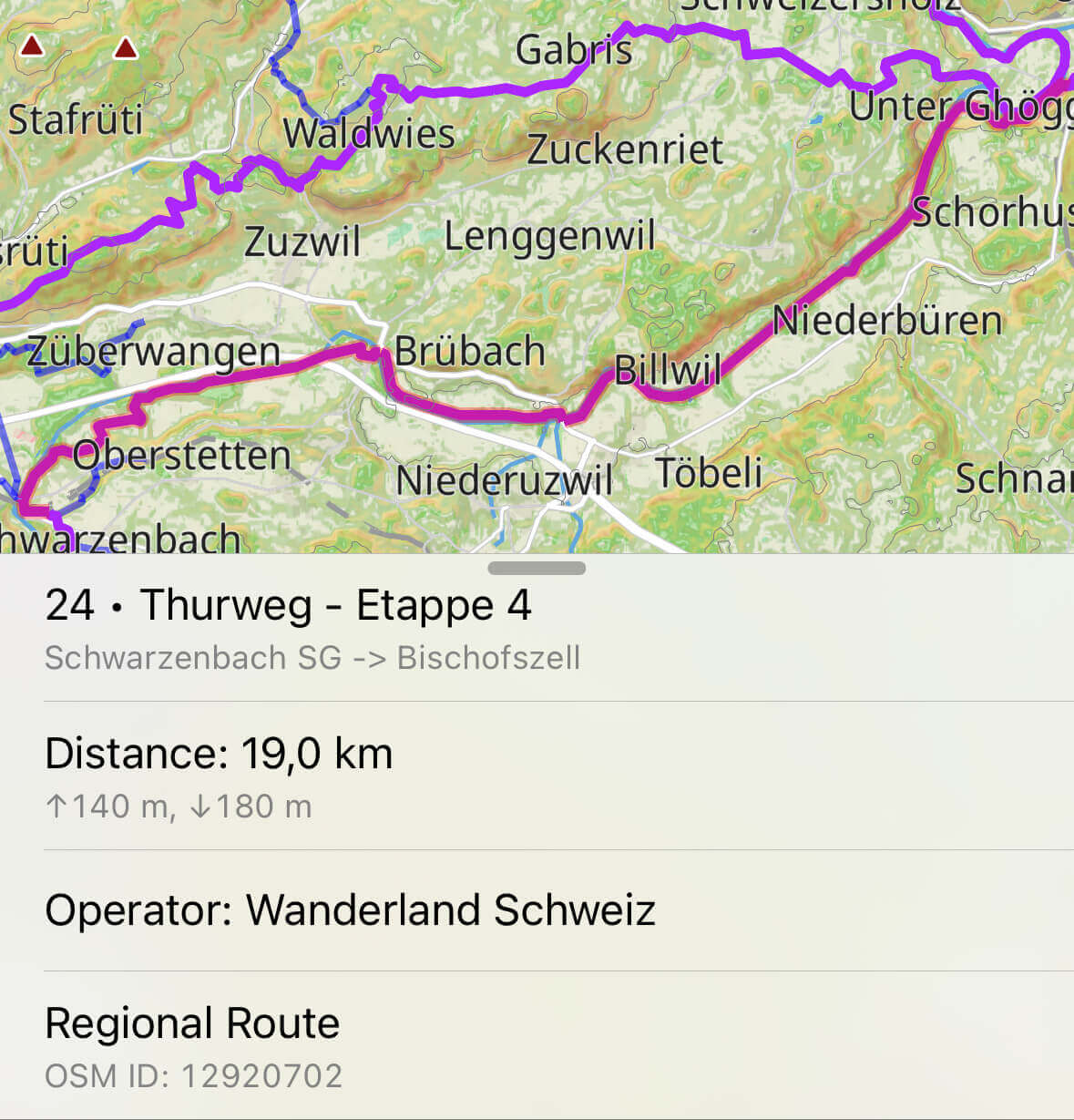
The routes in the app are available within the downloaded map. Therefore, for long routes going from one offline map to another, you need to select the next segment when crossing the border to continue your route.
It’s also easy to edit routes after your journey because the app links directly to OpenStreetMap.org.
If you know of a hiking route that is not on the map, or if an existing route needs to be updated, please email us and we will show you how: [email protected].
Hiking trail difficulties
When planning an outdoor activity, always consider the difficulty level so you know which skills and equipment are required. Guru Maps lets you set preferences for hiking-route complexity based on the SAC Hiking Scale while building your route.
Where to find it: Settings > Navigation > Pedestrian > Maximum Difficulty.
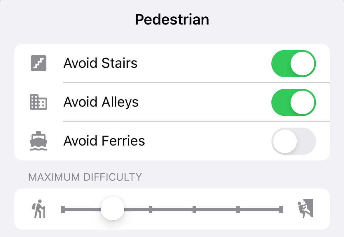
T1 – Hiking. Cleared and well-maintained easy trails. No special shoes or equipment necessary.
T2 – Mountain Hiking. Well-marked trail, possibly steep in parts. Hiking shoes are recommended and hiking sticks can be useful.
T3 - Demanding Mountain Hiking. Mostly marked, but the trail is not always visible. Good hiking shoes, map-reading skills, and basic alpine experience are recommended.
T4 - Alpine Hiking. A defined trail does not necessarily exist. Terrain is mostly exposed and the danger of falling is present. Good trekking boots, all-weather clothing, map-reading skills, and basic alpine experience are required.
T5 - Demanding Alpine Hiking. Often without a clear path and wothout easy climbing sections. Challenging terrain and snow-covered glaciers are to be expected. An ice axe and ropes may be required.
T6 - Difficult Alpine Hiking. Trails are generally unmarked. Expect extremely steep terrain with tricky rocky slopes and snow-covered glaciers. Extensive alpine experience and familiarity with technical equipment are required.
If you’re looking for a trustworthy hiking app that provides detailed topographic maps and a range of helpful offline features, Guru Maps is definitely worth considering. With the ability to plan and customize your routes based on your preferences and the SAC Hiking Scale, you can be confident that your next hiking adventure will be both safe and enjoyable.