Understanding GPS filtering

While recording a track, the app continuously retrieves data from your device's GPS module, updating the current position on the map in real time — typically every second to produce highly detailed tracks of your activities. The challenge is that sometimes (especially when accuracy is low) the values vary significantly, causing the current position to “jump” between distant points on the map.
The latest mobile phones are highly accurate and can locate your device with a precision of up to three meters, but environmental factors and device settings can still significantly affect accuracy.
With the GPS filtering feature, Guru Maps users can rely on more accurate and dependable recorded tracks for activities like hiking, cycling, or off-road adventures where precision matters.
What is GPS filtering?
GPS filtering in Guru Maps is a setting that improves distance and speed accuracy by eliminating location data outliers. These filters ensure that the tracks you record more closely reflect your actual journey.
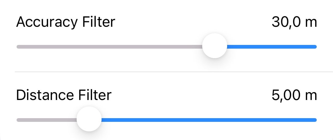
Accuracy filter
The accuracy filter enables you to establish a minimum accuracy level for the GPS points received. This filter works by excluding points with accuracy measurements beyond the specified threshold from appearing on the displayed track. Its purpose is to showcase only the most dependable and precise points on the track.
For instance, imagine you're walking around your neighborhood, and as you enter a supermarket, tall structures like walls and roofs obstruct the GPS satellite signal. Consequently, your device struggles to pinpoint your precise location. In such cases, activating the accuracy filter comes in handy. It helps hide GPS points that deviate too far from your actual location. If any received signals fall below the required accuracy, these points won't show up in the track display.
Distance filter
The distance filter allows you to set a minimum separation between consecutive points within a recorded track. Any points that are closer together than the specified distance will be filtered out and won't be visible on the track display. This filter is handy for decluttering and presenting a cleaner representation of your track.
For example, imagine you're jogging and pause to chat with a friend. Since the GPS updates location coordinates every second, numerous points are recorded at the same spot during your conversation, resulting in an excess of track lines. Enabling the distance filter hides GPS points that are too close together, eliminating unnecessary lines from the track display.
For detailed guidance on filtering GPS coordinates for tracks in Guru Maps, refer to the user manual available here: Filter GPS Data.