Meet Guru Maps for Apple Watch
· 3 min read

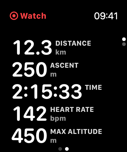
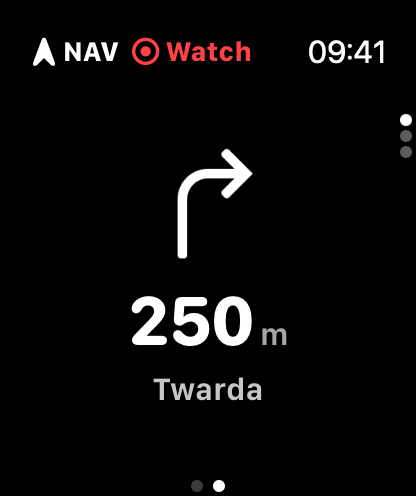
Guru Maps is now on Apple Watch! 🎉 Keep your iPhone in your pocket and follow your route or record your activity right from your wrist.
The idea is simple: your iPhone plans, your Watch follows and records. You pick a route or start an activity, and the Watch keeps the essentials in front of you — where to turn, how far to go, and how you're doing.