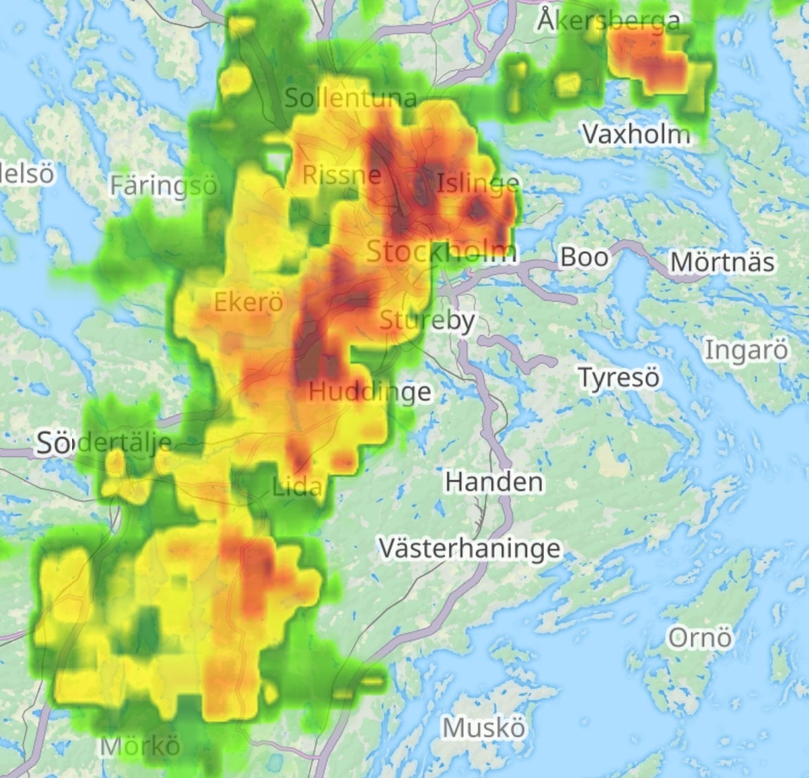
Precipitation intensity map overlay

We're thrilled to announce the new real-time weather map layer that shows the Precipitation Intensity within the Guru Maps app. Whether you're hiking through the mountains, cycling across town, or motorcycling down scenic routes, staying informed about precipitation intensity can significantly impact your safety, visibility, and overall experience.
Why precipitation intensity matters
Weather conditions are a critical factor to consider when planning any outdoor route. Understanding the instantaneous precipitation rate at ground level can help you make informed decisions about whether to start your journey or when to take breaks.
How it works
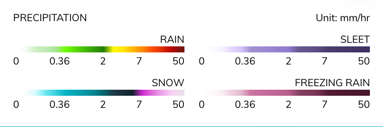
The Precipitation Intensity map overlay measures precipitation by calculating the amount falling at a given time, assuming a constant intensity.
According to tomorrow.io the rate is expressed in terms of length (depth) per unit time, such as millimeters per hour:
This data is updated every 5 minutes, giving you the most current information to plan your activities. To refresh the weather data, simply move the map to load the latest changes.
Update your Guru Maps app on iOS and Android today and take advantage of this essential new feature.
Stay ahead of the weather and navigate with confidence!