Analysis and visualization of GPS tracks

Our team has been hard at work for the last few months, and we are delighted to introduce all-new GPS track analysis and visualization features in Guru Maps, available with v5.4.0.
Whether you are hiking, biking, running, or simply strolling through the great outdoors, these new features empower you to analyze and visualize your activities in Guru Maps like never before.
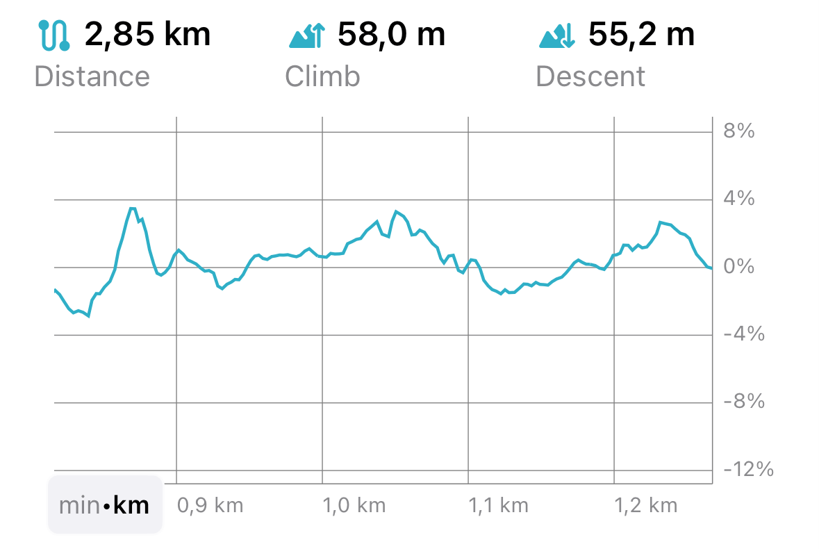
Detailed statistics for recorded GPS tracks
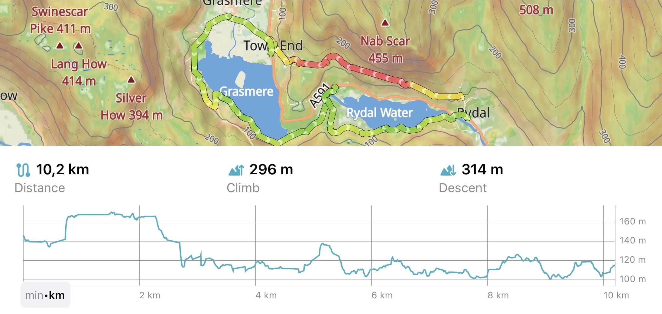
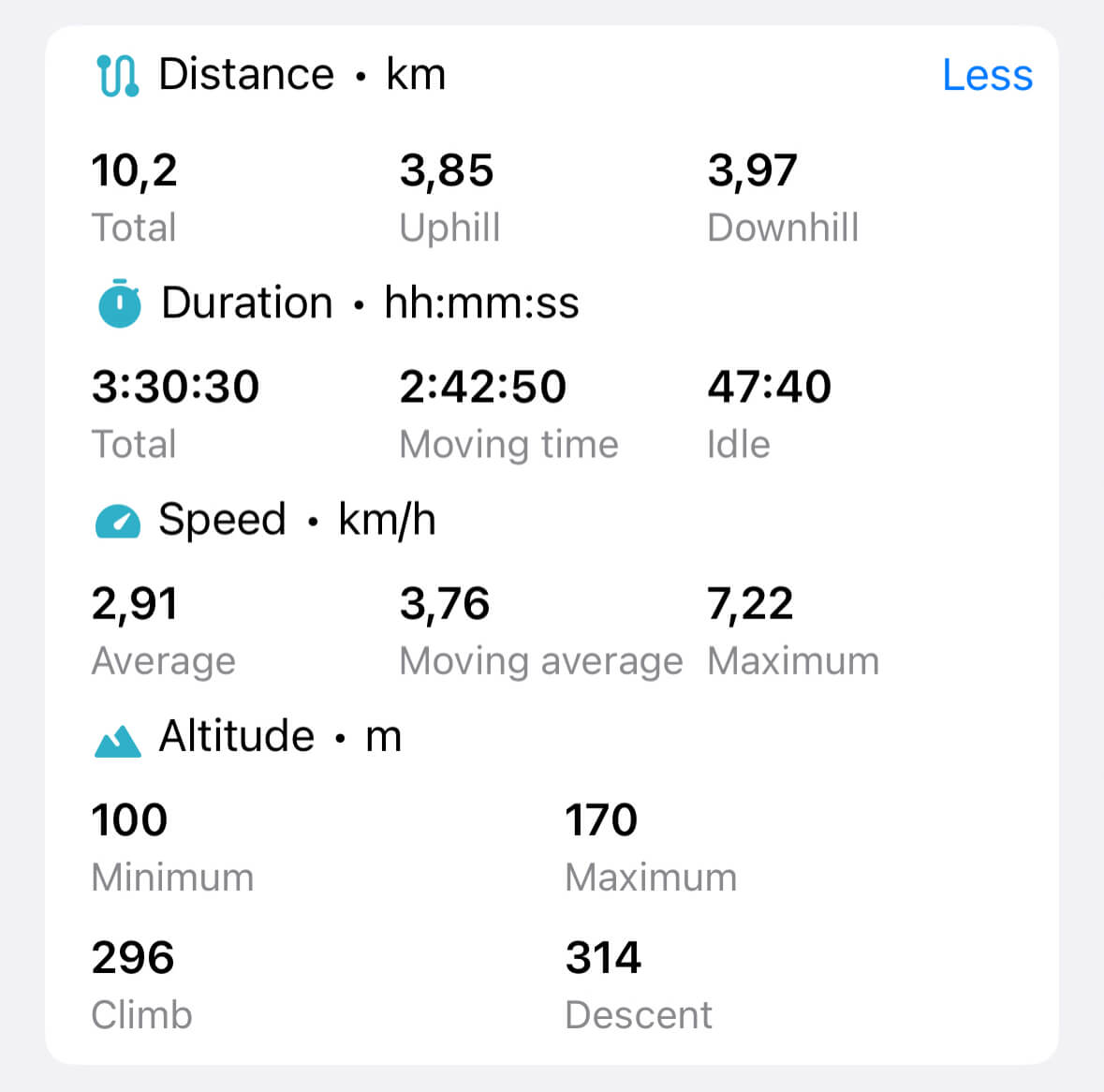
Now, when you record your GPS tracks using Guru Maps, you'll have access to detailed statistics that provide a comprehensive overview of your journey. From uphill and downhill segments to climb and descent measurements, elapsed time, moving and idle time, maximum and average speed, and more – everything you need to understand your performance is at your fingertips:
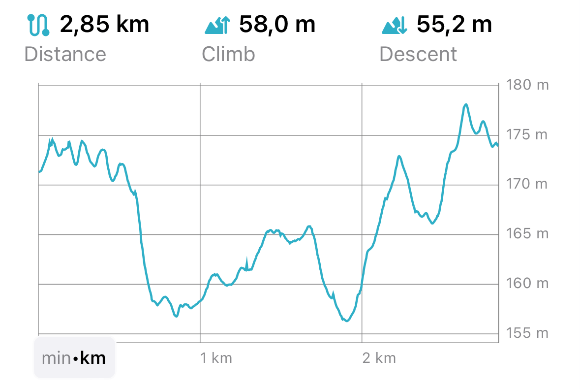
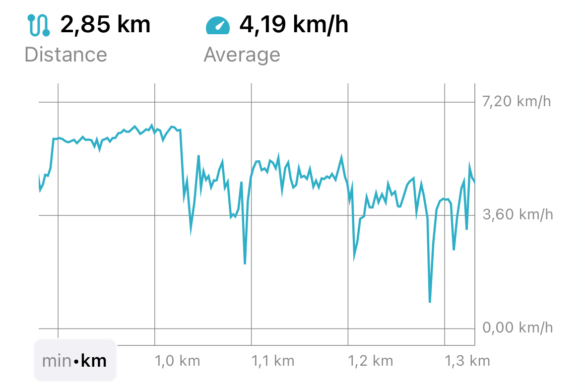
Elevation, speed, and slope profiles
Understanding your track's elevation changes, speed variations, and slope gradients is crucial for any outdoor enthusiast. With our new feature, you can visualize your GPS tracks through intuitive, interactive profiles. The elevation profile shows the highs and lows of your route, the speed profile lets you analyze how your speed changed throughout the journey, and the slope profile reveals the steepness of the terrain you conquered.
- Altitude
- Speed
- Slope
Elevation and altitude are two related but distinct concepts when it comes to GPS tracks in Guru Maps:
Elevation refers to the height of a specific point as measured from a DEM (digital elevation model) database. In Guru Maps we show elevation for created routes or imported tracks that lack altitude data.
Altitude reflects the vertical distance captured by your device while it records the GPS track.
GPS filtering
The raw GPS data received from your device can sometimes be affected by signal fluctuations, interference, or other inaccuracies inherent to GPS technology. This can lead to noisy and erratic track recordings, affecting the overall clarity of your route.
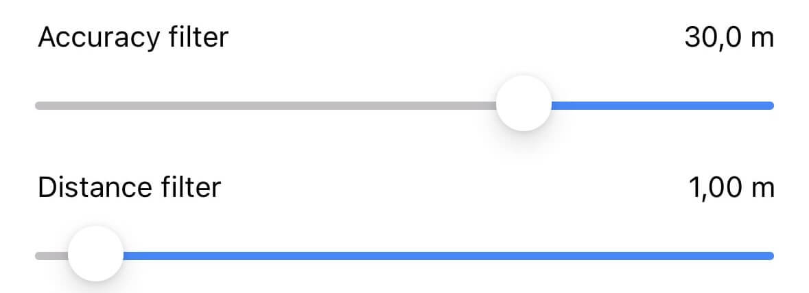
In the Guru Maps app, you can adjust the GPS filtering settings according to your preferences to get a smoother track. By fine-tuning the accuracy and distance filters, you can control the level of detail in your recorded tracks:
Accuracy Filter: Set the minimum accuracy required for GPS points. Points outside the specified threshold are filtered out and not displayed in the track.
Distance Filter: Specify the minimum distance between consecutive points. Points that are closer together than the specified value are filtered out and excluded from the track display.
To explore these powerful GPS filtering options and optimize your tracks, learn more about GPS filters in Guru Maps.
Additionally, we advise configuring the GPS filters as the default setting in the app's settings menu called "Tracks and Markers", ensuring that they will be automatically applied to all newly recorded GPS tracks.
And finally, we can't wait for you to explore all that the updated Guru Maps has to offer. Your feedback and support have been instrumental in shaping Guru Maps, and we couldn't have done it without you. So, feel free to record your GPS tracks with Guru Maps and uncover a whole new level of insight into your outdoor journeys.
Happy exploring and analyzing,
The Guru Maps Team